Gravières loop
Add to my favorites

Route opened
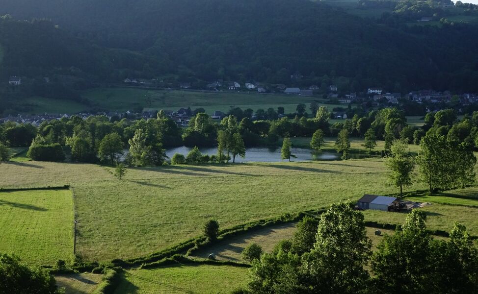
An easy family hike, you'll follow the banks of the River Cère before rising a little and ending up in a small forest. This short family hike has a few surprises in store, including a small lake hidden at the bottom of the valley.
The characteristics of the route.

Polminhac (15)
- Distance 3.11 km
- Elevation gain 60 m
- Elevation lost 60 m
- Min. elevation 636 m
- Max. elevation. 687 m
- Duration (depending on pace) 1h
- Marking Yes
Start from the parking lot near the soccer pitch.
After following the road that runs alongside the River Cère, take the path on the right that passes close to the Lac des Gravières (you'll see it from a little higher up when you reach "La Gentie"); the path climbs back up and joins the départementale. When you reach Marfons, turn left to reach "La Gentie": beautiful view of the village of Polminhac and Lac des Gravières. The path then descends into the undergrowth and continues through meadows before rejoining the road and then the starting point.Marking : Marked-out walking route - Blue markingEquipments : Car park, Admission fee : Free access.Opening : All year round daily. Subject to favorable snow and weather conditions.
After following the road that runs alongside the River Cère, take the path on the right that passes close to the Lac des Gravières (you'll see it from a little higher up when you reach "La Gentie"); the path climbs back up and joins the départementale. When you reach Marfons, turn left to reach "La Gentie": beautiful view of the village of Polminhac and Lac des Gravières. The path then descends into the undergrowth and continues through meadows before rejoining the road and then the starting point.Marking : Marked-out walking route - Blue markingEquipments : Car park, Admission fee : Free access.Opening : All year round daily. Subject to favorable snow and weather conditions.
Area : Polminhac
Report a problem
Gravières loop_Polminhac
Add your time and share your feelings
Services nearby

Camping du Val de Cère
Polminhac

Ô 2 Potes au Feu
Polminhac

Usse Jeannette
Polminhac
Puybouffat André - "Le Bout du Chemin"
Vic-sur-Cère
La Fourniou
Polminhac


Information updated on 2026-05-12 by Office de Tourisme du Carladès


Follow us on
the digital trails
the digital trails


![]()
Contact
Carladès Tourist Office
Avenue A. Mercier
15800 Vic-sur-Cère
Tel. 04.71.47.50.68
Carladès Tourisme
tourisme@carlades.fr
 Espace Trail Carladès - Parcours - Gravières loop
Hello, world! This is a toast message.
Espace Trail Carladès - Parcours - Gravières loop
Hello, world! This is a toast message.
Espace Trail Carladès - Parcours - Gravières loop
Hello, world! This is a toast message.


OK
Annuler